


New Delhi: After a brief respite from heatwave conditions due to rain and storms in the past two days, the capital is likely to see temperatures rise again from April 16 onwards as the influence of a western disturbance wanes.
Earlier, Delhi experienced a heatwave for three consecutive days from April 7 to 9, with temperatures at Safdarjung, the city’s base station, staying above 40 degrees Celsius. Parts of the city remained under heatwave conditions on April 10, with residents experiencing warm nights for two straight days.
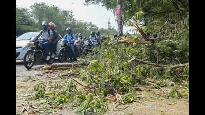
Relief came on Thursday evening with rain and gusty winds, followed by a severe thunderstorm on Friday evening that kept temperatures in check on Saturday. The maximum temperature on Saturday was recorded at 35.2 degrees Celsius, one degree below normal, while the minimum temperature stood at 19 degrees Celsius, two notches below normal.
“As the impact of the western disturbance is over, both day and night temperatures are likely to show a marginal rise from Sunday. However, heatwave conditions are likely in the city from April 16 to 18,” said a Met official.
According to India Meteorological Department (IMD), Sunday’s maximum temperature is expected to stay between 36 and 38 degrees Celsius but may rise to around 40-42 degrees Celsius by April 16. IMD forecasts “no significant change in maximum temperatures over the next two days and a gradual rise by 3-5 degrees Celsius thereafter.”
IMD defines a heatwave day when the maximum temperature is 4.5 degrees or more above normal and at least 40 degrees Celsius, or when it touches 45 degrees Celsius or above. A ‘severe’ heatwave is declared when the maximum is 6.5 degrees or more above normal.
Meanwhile, Delhi’s air quality remained in the ‘moderate’ category with an AQI of 164. While it is expected to stay ‘moderate’ on Sunday, the Air Quality Early Warning System for Delhi predicts it may deteriorate to the ‘poor’ category on Monday and Tuesday.


