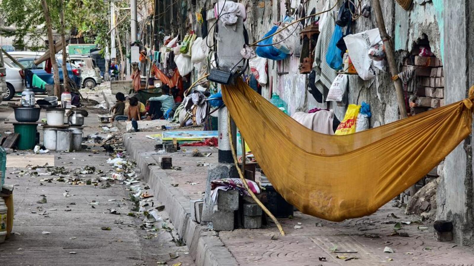
MUMBAI: The Walking Project, a social initiative by an NGO that is working to make MMR walkable, has been conducting regular walks along with citizen participation, since August 2023, in different parts of the city, to analyse the conditions of walkability against the benchmark set by the Indian Roads Congress (IRC) guidelines. The team, Rishi Aggarwal, Vedant Mhatre and Aishwarya Tatke have till date completed 34 walks, covering a distance of over 65 kilometers. Team HT — Sabah Virani, Shashank Rao and Shreya Jachak — joined them on a few, and came away with these observations.

Byculla station to Delisle bridge
Visit: March 21
To our surprise, we had a great start with the pedestrian conditions in the area around busy Byculla station, except the dangerous road crossing.
British standards of planning have ensured the footpaths are comfortably wide – at a minimum of six metres — coming very close to the IRC’s parameters for streets with heavy footfall and commercial activity. IRC envisions three zones on footpaths for ease of commerce and walking.
The frontage zone – the space close to a wall or building – had enough space for small commercial enterprises to function: you can grab a vada pav from one of the shops before you board a train home. The zone towards the edge of the road – the multi-utility zone — has hawkers, utility boxes, bus stops, benches, trees and signage; the middle left free for pedestrians. We even spotted a koyal on a mulberry tree. “Walks in this part of the city are joyful because of elements like these,” said Rishi Aggarwal.
While the existence of disparate elements on a footpath seemingly defies the definition of a footpath, they add value, as Aishwarya Tatke said: “Streets should be lively. The more people on them, including hawkers, the more incentive each of them has in keeping the place safe. This is the idea behind the urbanologist Jane Jacobs’s concept of ‘Eyes on the Street.’”
Thanks to the adequate width, even with bikes parked in the multi-utility zone, the pedestrian zone formed in the middle did not feel like a tight squeeze.
But not everything was by the book.
The footpath broke continuity at the points where a side street intersected with the main road — the places where gradual slopes met the road to allow seamless walking, was crowded with bikes. While bollards had been placed to block bikes from spilling on the footpaths, due to a Bombay high court ruling to ensure accessibility for wheelchairs, one in each set had been razed, defeating their purpose. Vedant Mhatre called this “a waste of public money”.
Things took a turn for the worse starting from the S-bridge signal along the NM Joshi Marg – the pedestrian timer on the traffic signal had a wait time of 140 seconds, but the signal blinked at eight seconds, leaving us with not enough time to cross.
The width of the footpath from thereon decreased dramatically, thanks to an ongoing road widening project.
As we walked on to Chinchpokli station, patches of footpath returned to better widths, although inconsistent, forcing pedestrians to walk on the road. The old rain trees in the Chinchpokli Jewish cemetery, however, offered some respite.
At Delisle bridge, the BMC had finally put up guardrails to add a barrier for the pedestrians walking along to get to Currey Road station, after months of having kept only traffic cones with a loose rope. It was still a far cry from the vast footpaths the British-era bridge offered not long ago.
Grant Road station to Nepean Sea Road
Visit: March 24
The first sight to hit us at Grant Road station was an all-consuming Mumbai malaise — road concretisation. And as if that were not enough, BMC is repaving footpaths alongside. Both BMC officials and road contractors said they go by the set principle of keeping to the existing width of the footpath, unless there is a strong demand from residents otherwise.
Walking ahead, we soon encountered BMC’s pride – the skywalk at Nana Chowk, majestic in look, but severely underused. The reason is clear: to reach it, one has to climb 60 steps.
“When pedestrians want to cross the road, which is a short distance, they’re not going to go through such lengths to use a skywalk,” said Mhatre, pointing at a crossing at the junction that lacked the zebra marks. “The escalators have been set up to make it user friendly, but it is almost always not working.”
Sure enough, we found the door to the escalator chamber locked.
On the brighter side, we found footpaths on this stretch, along the ‘Freedom Trail’ of August Kranti Road, wide at eight meters for people to walk at a leisurely pace. Mhatre pointed out that most footpaths in the ward had been redone in the past two years, replacing them with in-situ cast concrete — a sturdy material able to withstand high footfall. Contrary to public opinion, even paver blocks are a good material, he said, if they are fit properly and are not dug up repeatedly. Basalt rock is one of the best due to its strength, but needs to be filled in the gaps with concrete to prevent tripping hazard. Stamped concrete, on the other hand, degrades with wear and tear.
The footpaths’ gradient slope where side streets interrupted the flow also came close to IRC standards, said the team. “A tabletop crossing is the best, wherein the road at an intersection is raised to the height of the footpath with slopes presented for vehicles. Vehicles slow down, while pedestrians get a continuous and consistent walkway,” said Mhatre.
At Nepean Sea Road, where most of Mumbai’s HNIs reside, the footpath dried up. Barely around one-meter wide and missing at certain stretches, they were hidden behind parked cars. People waiting at bus stops stood on the roads, as the buses approaching were not visible thanks to the cars obstructing the view. But this is how the residents prefer it, said Mhatre, thanks to their dependence on cars.
“Residents of buildings here fought with us to ensure the footpath widths were not increased at all,” said Pranav Naik, an architect from Studio Pomegranate, who had worked on a project here.
To end the walk, the team stopped at a little alcove on a slope in the midst of the buildings titled Nepean Sea Green, an unused space transformed into an expanse with trees and wide steps where people sat for a little rest and took pet dogs through on their walks. The residents had opposed this too, for fear of it being “misused,” but their dread was misplaced.
S V Rd to Lucky Junction, Bandra
Visit: March 27
Navigating the Queen of the Suburbs is no mean feat. The condition of roads and footpaths in Bandra is no secret: there are unlevelled pathways, while hawkers and vendors occupy the footpaths, leaving little space for pedestrians. We began our walk from the Andheri end of S V Road.
This junction is heavily used by pedestrians in the midst of the menace created by unruly auto rickshaw and two wheeler drivers. The timer on traffic signals were off, while the zebra crossing was faded.
The footpath was narrow, at barely two meters. The traffic island at this junction, which ideally should make way for pedestrians to stand, has been eliminated by beautification.
One can barely accomplish a straight walk – the footpaths are narrow, abrupt and curve steeply. There are trees planted at a distance, electric junction boxes with leaking cables are seen lying on the footpath, while under construction buildings have encroached parts of the footpath. The ongoing metro rail and road works at the median further make walking difficult.
Rishi Aggarwal said: “Ideally the width of a footpath should be between four and six meters on each side of a road. But that norm is almost never met. Also, the height of the footpaths in many places make it a challenge for senior citizens to use.”
At most stretches, the height of these footpaths is between eight and 12 inches, defying the established norm of six inches. We measured this, much to the amusement of curious shopkeepers and bystanders. “While this is hazardous for senior citizens, metal barricades at many places on the stretches are equally unwanted. We want adequately wide unobstructed footpaths, well maintained surfaces, sloped kerbs for accessibility, and traffic islands for safe crossings,” added Aggarwal.
Locals we met said footpaths are of the width of two-and-a-half meters as the road has been widened over time. As if that were not enough, shops have been set up on the footpaths, leaving miniscule space for walkers. There are BEST bus stands on the edge of the footpaths which make it difficult for passengers and pedestrians equally to both walk or wait for a bus.
Holy Family Junction, Chakala, to Chakala metro station
Visit: March 31
This busy business hub sees tens and thousands of people walking to their work places either directly from the railway station, closest metro station or BEST bus stop. However the state of the footpaths are such that pedestrians are compelled to shift their steps between the roads and the footpath frequently.
We began our walk from the Holy Family High School junction at around 4.30 pm – a walking distance from WEH/ Gundavali metro stations, the footpath under the stations is occupied by food vendors, encroached by shops owners, hawkers and temporary stalls, leaving little space to walk.
A little ahead, we found the footpath had strangely disappeared – the walkway is interrupted with uneven slopes connecting the road to residential buildings along its inner edge to make way for private vehicles to pass. After 100 meters, as we started walking on the Mahakali Caves Road that leads to prominent business centres that house corporate offices, footpaths are eliminated. “There is ample space to widen the footpath up to six meters from the current 1.5-2 meters. This should be done to ease walkability. On a weekday, many people are forced to walk on the road as the footpath is narrow and poorly maintained,” said Aggarwal.
There are certain areas opposite well-known business hubs like MIDC and Technopolis Business Park which are bereft of footpaths. It is a common sight to watch people waiting at the bus stop for the BEST bus to arrive, further reducing the space to walk.
Another busy junction opposite MIDC and Ahura (business park) is bereft of a traffic island for pedestrians to wait, while the footpath around the corners are blocked by damaged destination boards and loose cables lying carelessly. There are metal barricades too installed on the footpath which make it inconvenient for any person to shift from the road.
As we moved towards Chakala metro station, passing through MIDC Police Station, we found the footpath becoming narrow again. Around the industrial estates and commercial offices, tempos occupy the road blocking entry into the footpath. Shops and small take-away joints have used the footpath to stock their wares. After walking for around 25-30 minutes covering distance of close to 1.8 kilometers we reached the metro station.
Vikhroli Station to Kanjurmarg Station along LBS Road
Visit: March 28
The first sight that greeted us as we walked the over two-kilometer stretch on Lal Bahadur Shastri Marg from Vikhroli station to Kanjurmarg station, are the many ongoing developmental projects – the construction of the Metro Green Line 4 at Kanjurmarg being crucial.
“With all the upgradation in sight, are footpaths a part of the development plan?” asked Vedant Mhatre.
Our walk from Vikhroli station started on a ‘kaccha road’ with no footpath visible on either side. “Even though it is an essential connector to the station, it is a disputed land (between a private party and BMC) so the road was never developed,” explained Mhatre. Further on the right, down the LBS Road we started walking on an uneven footpath, made of concrete, for a few meters which abruptly ended in the middle with a shop’s entrance; next to it was the gate to a building leading with a slope.
Out of nowhere, a footpath of at least 2 feet height started which a senior citizen or a person with disability would dare not climb, and even if they did, they would only have to get down as the path ahead is dug up.
The stretch till Kanjurmarg has several residential buildings, a corporate building and a crucial metro junction — the footpath in the front was either obstructed by slopes leading to buildings, partially covered manholes or utility pipes and boxes. On the way, next to a corporate park’s entrance, street food vendors had taken up half of the footpath for their stalls and the rest was being used to seat customers on-the-go. There is no option here but to walk on the road. “Steel railings are ideally supposed to be placed near schools or hospitals,” said Mhatre, pointing to railings abruptly placed throughout the route, barks of chopped trees, to facilitate work for metro, strewn around forcing pedestrians to walk back a few steps and take the road. Going ahead was a sewage gutter guarded with a metal net and secured with cement on the edges to keep it in place. People walked over it. Up ahead a bench was found right in the middle of the walkway and next to a bus stop. The path further narrowed down, while for over 300 meters from the spot the footpath had disappeared. People walked on the shoulder area of the road which was a no-parking zone.


